 iengineers.info Ειδήσεις και νέα από τον χώρο της μηχανικής.

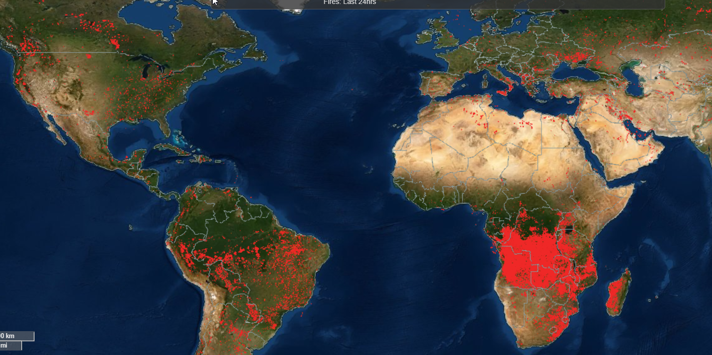
Το σύστημα NASA FIRMS μεταδίδει δεδομένα από τα ενεργά μέτωπα πυρκαγιών σε όλο τον πλανήτη.
The Fire Information for Resource Management System (FIRMS) distributes Near Real-Time (NRT) active fire data within 3 hours of satellite observation from the Moderate Resolution Imaging Spectroradiometer (MODIS) aboard the Aqua and Terra satellites, and the Visible Infrared Imaging Radiometer Suite (VIIRS) aboard S-NPP and NOAA 20 (formally known as JPSS-1).
https://firms.modaps.eosdis.nasa.gov/map/#d:2021-08-04..2021-08-05;l:country-outline;@-4.2,9.1,3z
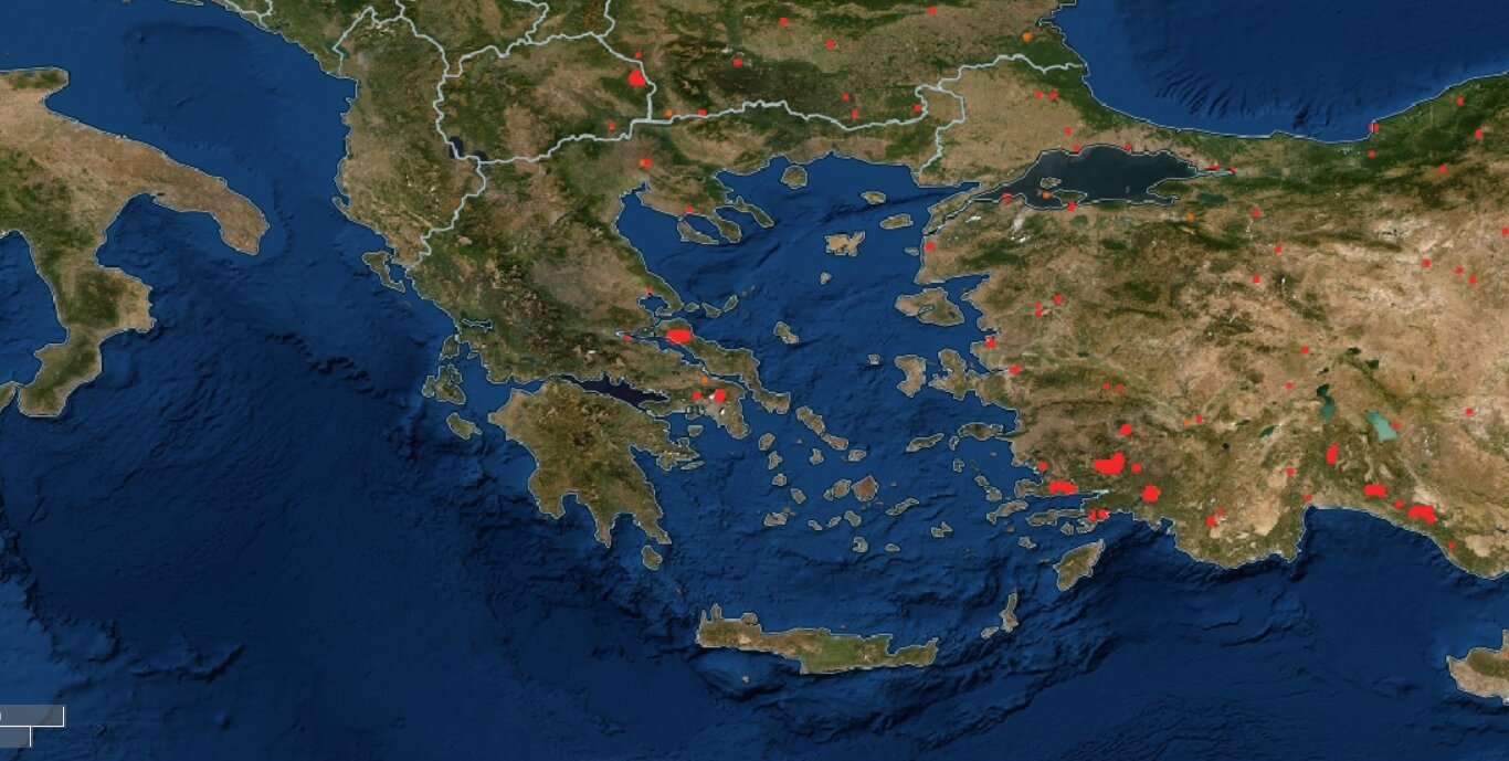
Και η εικόνα για την Ελλάδα:


